
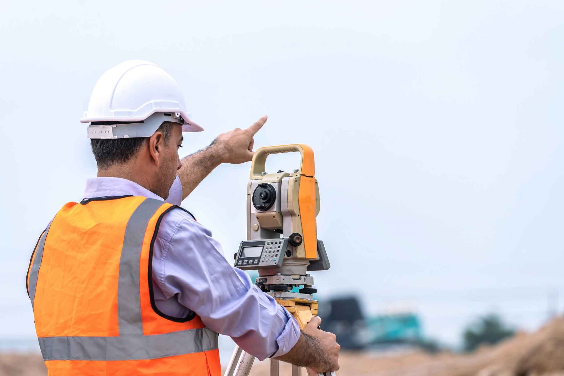
Property Surveying Services
In the industry of land divisions in South Australia and Adelaide, the choice of surveyors holds immense significance. At John Bested Surveyors, our commitment to excellence stands as a beacon for those seeking unparalleled proficiency in this domain. Our dedication to precision and accuracy is unwavering, ensuring that every project undertaken is marked by a standard of quality that resonates with high standards.
Our Land Divisions
When individuals or local governments in South Australia and Adelaide seek a partner for land divisions, they are essentially seeking a blend of expertise and reliability. This is where John Bested Surveyors shines bright, offering a proven track record of successful projects that have not only met but surpassed expectations. Our team's collective knowledge and experience form the bedrock upon which we deliver results that speak volumes about our capabilities.
Moreover, at John Bested Surveyors, we understand that each project is unique, presenting its own set of challenges and intricacies. This comprehension drives us to approach every undertaking with a fresh perspective, tailored to the specific needs and requirements of our clients in South Australia and Adelaide. We believe that effective communication and collaboration are key to ensuring that the end result aligns seamlessly with the vision set forth at the project's inception.
In a landscape where precision is paramount and attention to detail is non-negotiable, choosing John Bested Surveyors emerges as a decision rooted in trust and assurance. Our reputation precedes us, echoing the sentiments of those who have benefited from our services in the past. Clients in South Australia and Adelaide can rest assured that with us, their land division projects will be handled with the utmost care and proficiency, leading to outcomes that exceed all expectations.
The choice of surveyors for land divisions should not be taken lightly. It requires a keen eye for detail, a penchant for precision, and a commitment to excellence. At John Bested Surveyors, we embody these qualities and more, positioning ourselves as the partner of choice for those in South Australia and Adelaide who seek nothing short of exceptional results in their land division endeavors.
Continue reading or reach out to learn more.
Our Expertise in Land Divisions
In the competitive field of land divisions across South Australia, the choice of surveyor is crucial. At John C Bested & Associates, we offer a proven track record of successful projects with a commitment to precision and reliability. Every project is unique, and we tailor our approach to meet each client's specific needs, whether it's a residential development or a commercial property subdivision.
We also coordinate with statutory and local government authorities to ensure smooth approvals, helping you confidently navigate the complexities of land division. Our in-depth knowledge, meticulous attention to detail, and clear communication make us the trusted partner for property owners and developers across South Australia.
Land Division
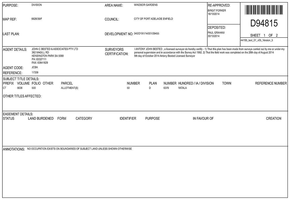
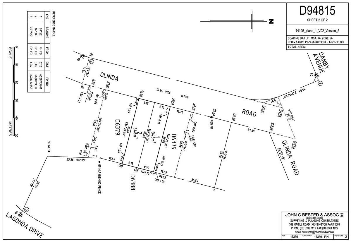
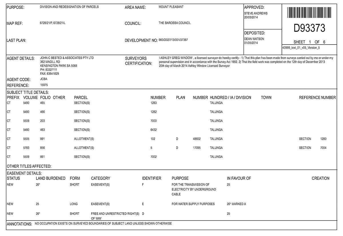
The Torrens title system of land ownership is a method of registering titles to land parcels, where a register of holdings maintained by the Lands Title Office guarantees an indefeasible title to those registered parcels.
In simple terms Torrens title land division involves either the subdividing of a parcel of land into two or more allotments or the alteration of boundaries between adjoining allotments.
Land division can be a costly and lengthy process requiring the approval of many statutory and local government authorities.
At John Bested Surveyors we offer a full range of services to assist our clients who may be contemplating subdividing property.
John Bested Surveyors will prepare and lodge the initial land division application and liaise with the various statutory and local government authorities in order to obtain all necessary approvals for the land division. We undertake all necessary survey work, procedural applications and prepare final plans of division for lodgement at the Lands Title Office.
With our knowledge and expertise we will guide you through the entire land division process.
Benefits of Choosing Us for Your Land Divisions
When it comes to land divisions in Adelaide, selecting the right surveying team is crucial to ensuring a smooth, legally compliant and efficient process. At John Bested Surveyors, we bring decades of local experience, technical expertise and a thorough understanding of South Australian cadastral standards to every project. Our licensed surveyors are trained in the latest mapping technologies and planning protocols, enabling us to deliver precise boundary determinations and subdivision plans tailored to your specific property requirements.
Our commitment to quality and client satisfaction sets us apart in the industry. We work directly with landowners, developers and legal professionals to ensure all documentation meets council and Land Services SA requirements, minimizing delays and reducing the risk of costly errors. With a streamlined approach to cadastral surveying and subdivision planning, we help clients navigate complex regulatory frameworks with confidence. Choosing John Bested Surveyors means partnering with a team that values accuracy, transparency and timely delivery — essential qualities when undertaking any land division project in Adelaide.
In addition to our technical proficiency, we pride ourselves on maintaining open lines of communication throughout each stage of the surveying process. From initial consultation to final plan lodgment, we keep you informed and involved, ensuring your objectives are met efficiently and professionally. For reliable, experienced and locally informed service, contact John Bested Surveyors at (08) 8332 7111.
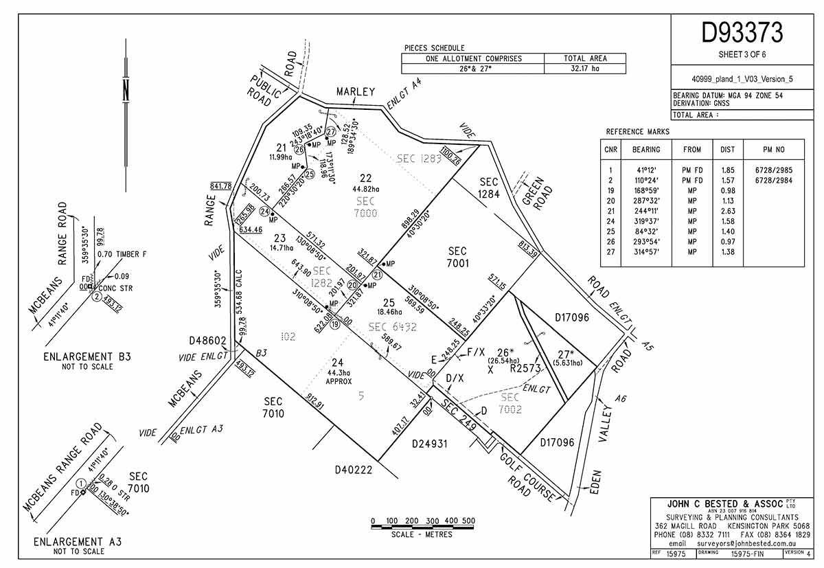
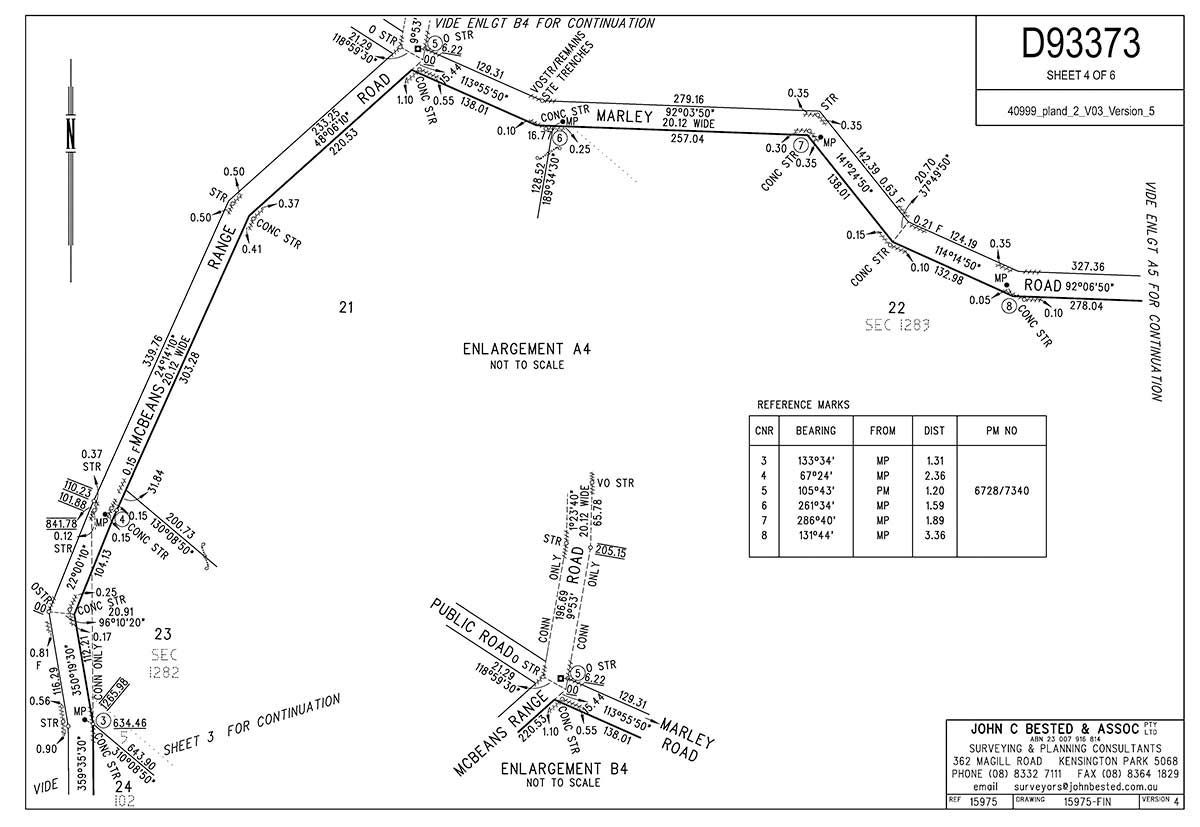
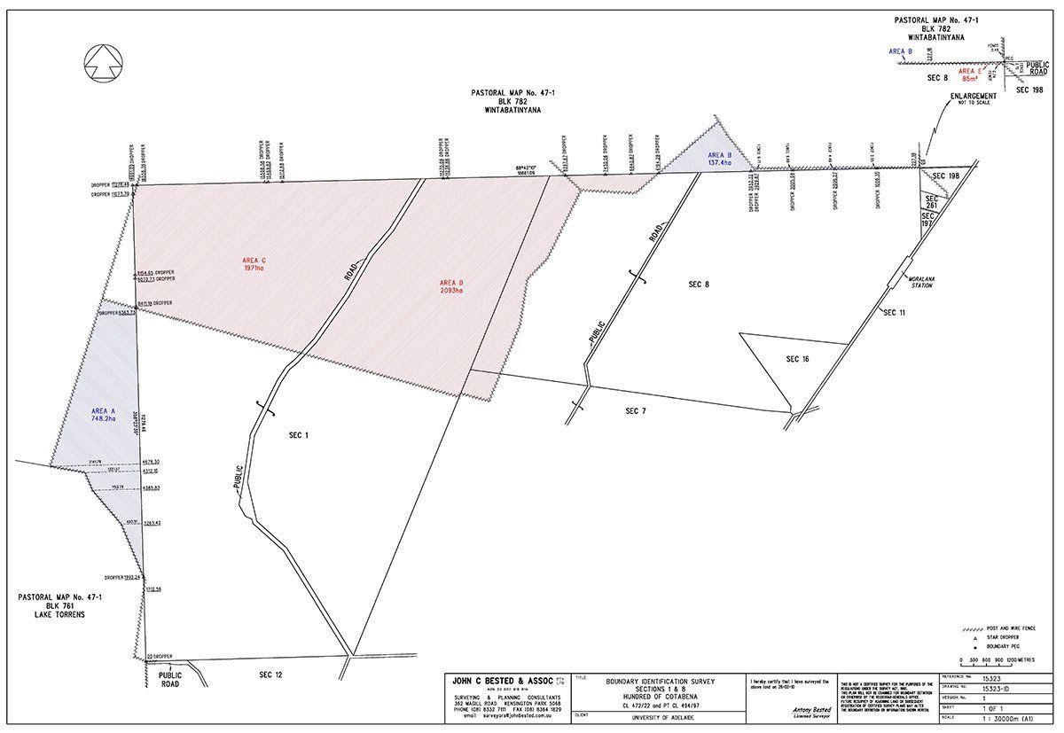
Urban Land Division
Rural Land Division
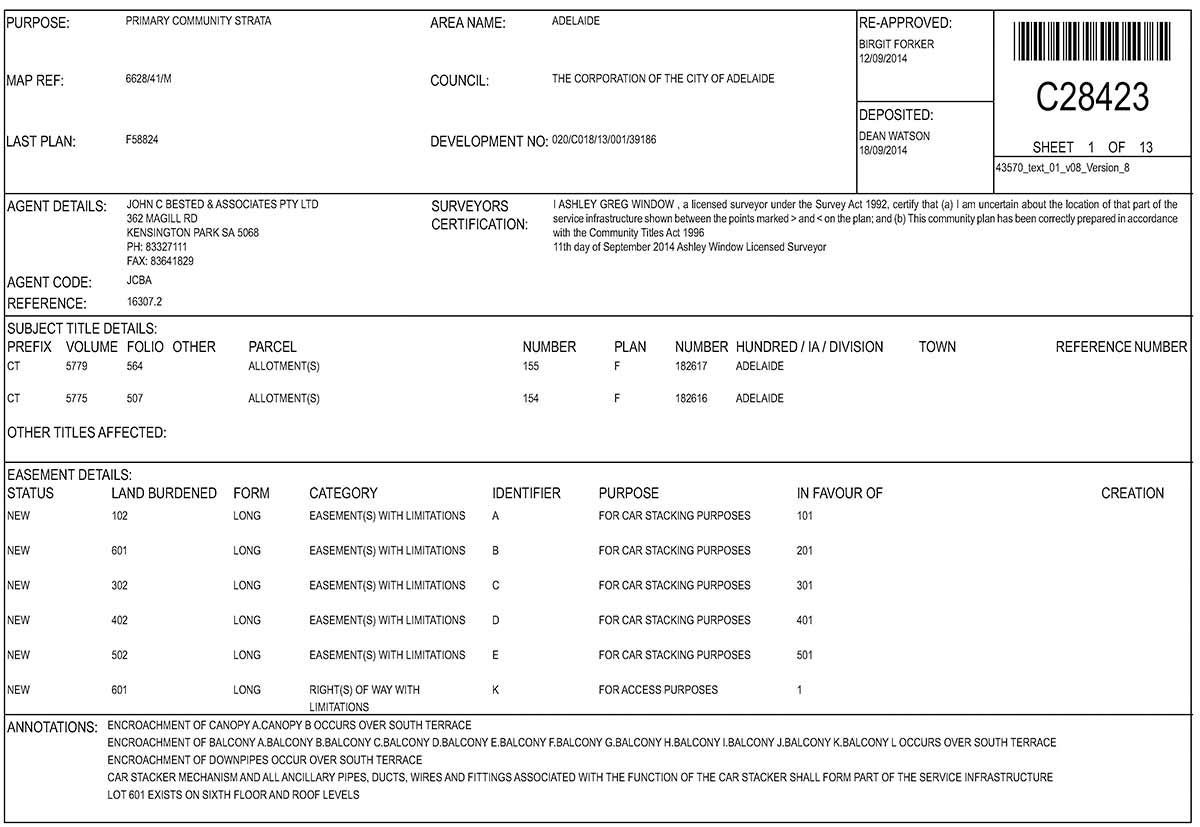
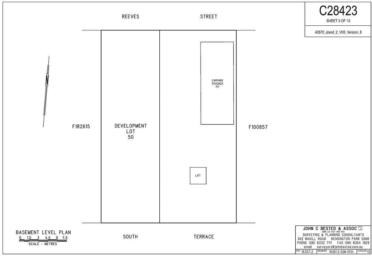
COMMUNITY TITLE DIVISION
Community titles can be likened to 'strata titles' without some of the burdensome responsibilities and limitations imposed by the older style 'strata title' development. Community division is the division of land into at least two lots, common property and the creation of a management corporation referred to as the 'Community Corporation" where each lot can be dealt with under the Real Property Act. It is the role of the Community Corporation to administer, manage and maintain the common property as well as to enforce the by-laws and any other roles assigned to it by the Community Titles Act. At John Bested Surveyors we have a wealth of experience with Community Scheme developments and will guide you through the entire Community division process.
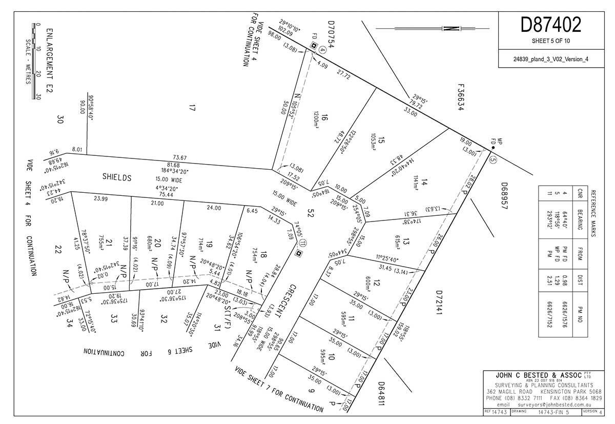
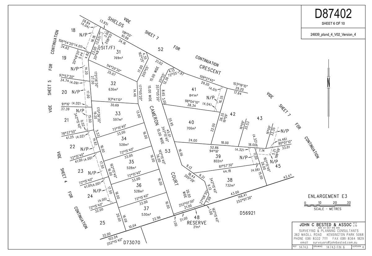
Subdivision
Each subdivision project is unique, whether you are developing an industrial park or multistage residential estate John Bested Surveyors has the experience and resources to assist you with your development.
- Design layout for small, medium and large subdivision developments
- Preparation of draft subdivision plans and lodgement with the State Commission Assessment Panel (SCAP)
- Manage the subdivision process through to the issuing of titles for the new allotments
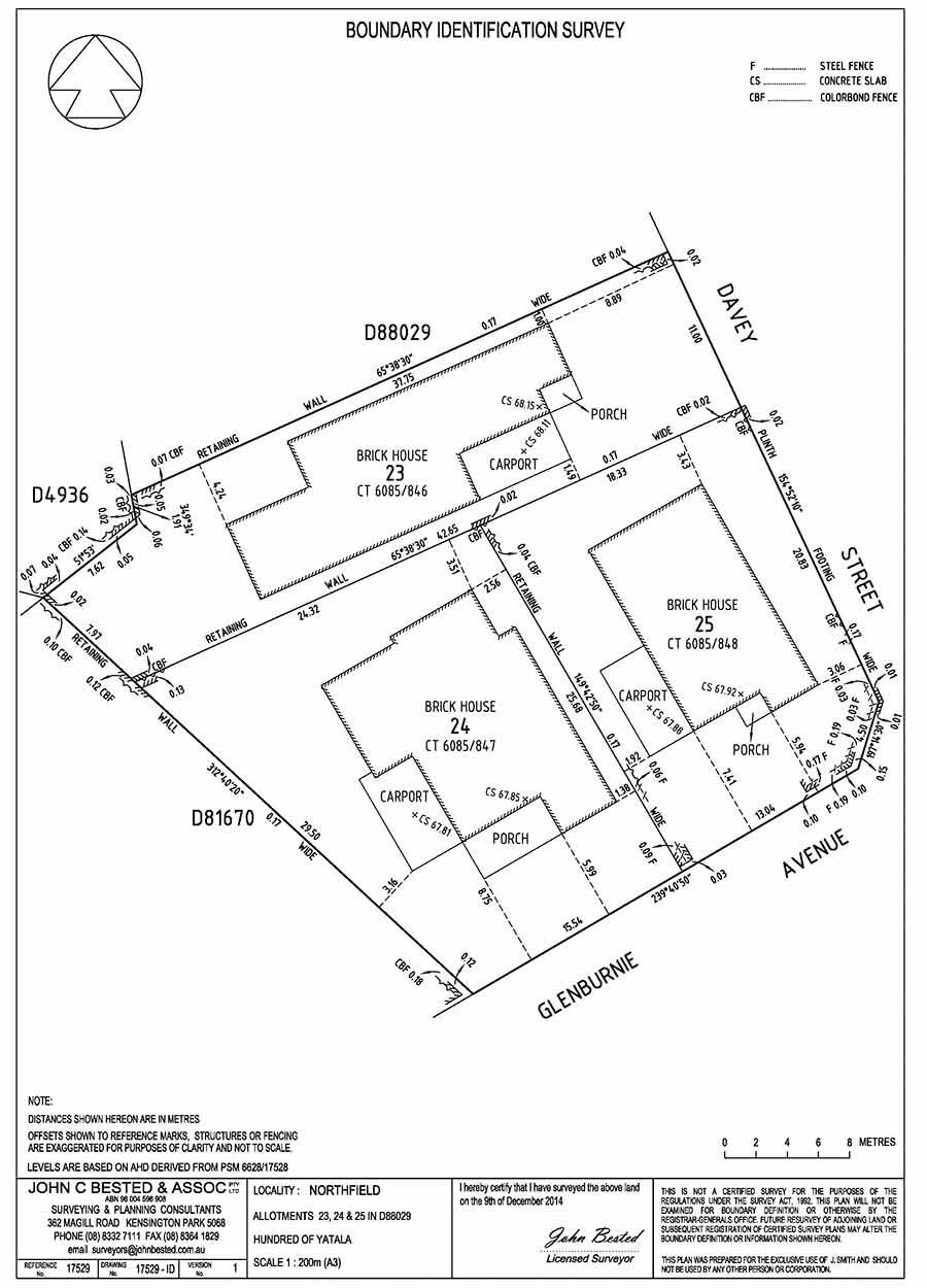
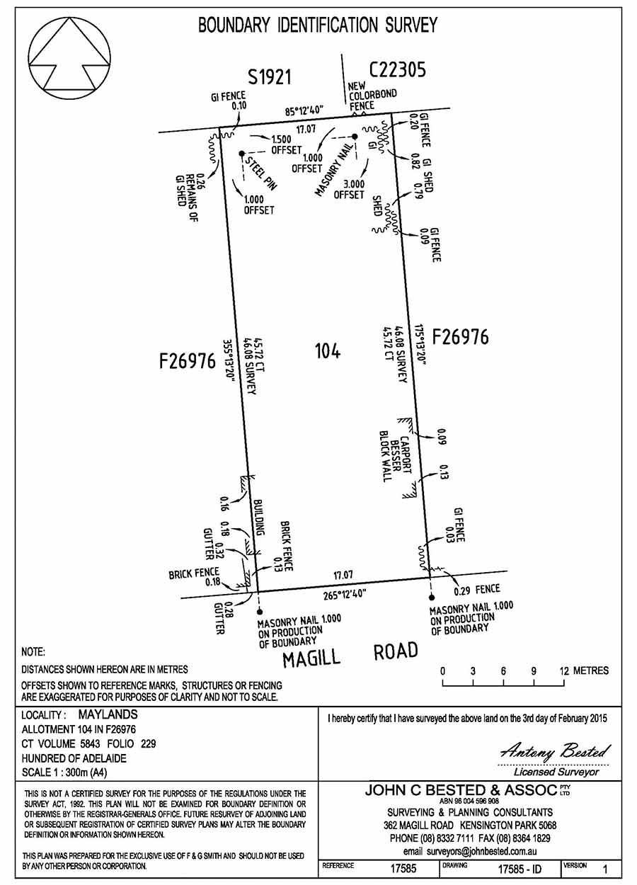
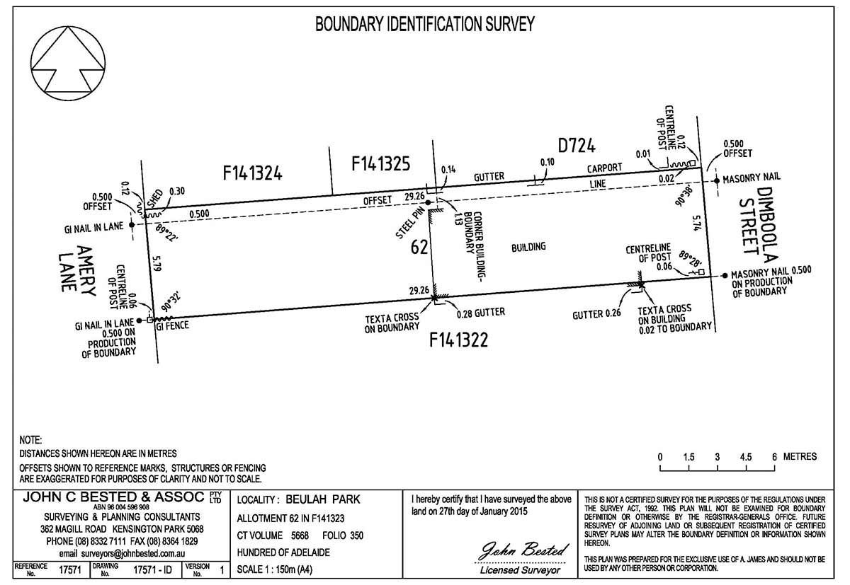
Boundary Identification Surveys
A boundary identification survey ensures compliance with the legal property lines if you are building, renovating, or fencing near a property boundary. This survey:
- Marks existing title boundaries
- Identifies easements, nearby structures, and encroachments
- Provides accurate documentation for construction or development projects
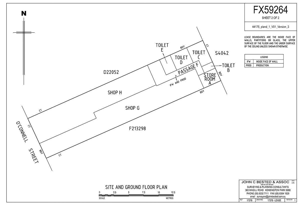
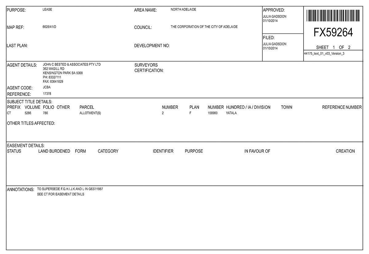
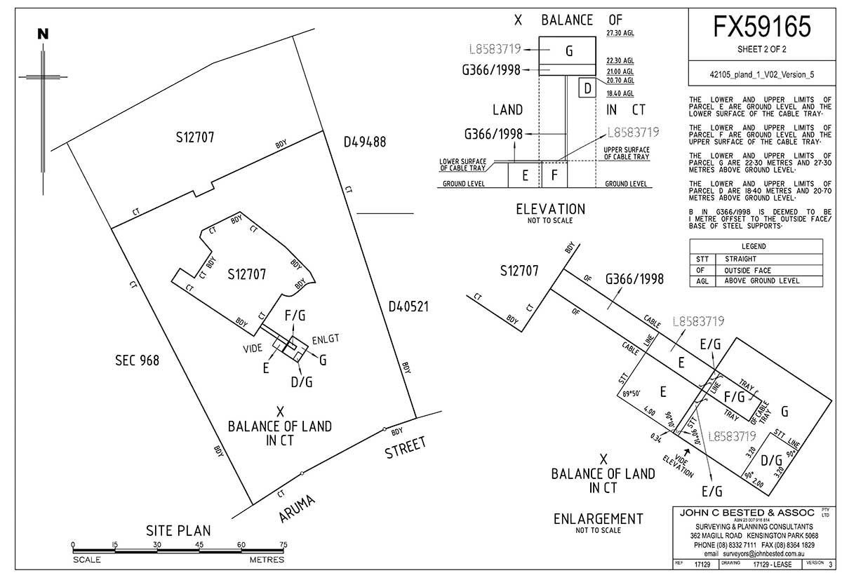
Lease Plans
For developers, property managers, and landlords, we prepare accurate lease plans for:
- Offices
- Retail spaces and shopping centres
- Warehouses
- Telecommunication towers
Our lease plans ensure smooth leasing processes across commercial, industrial, and residential properties.
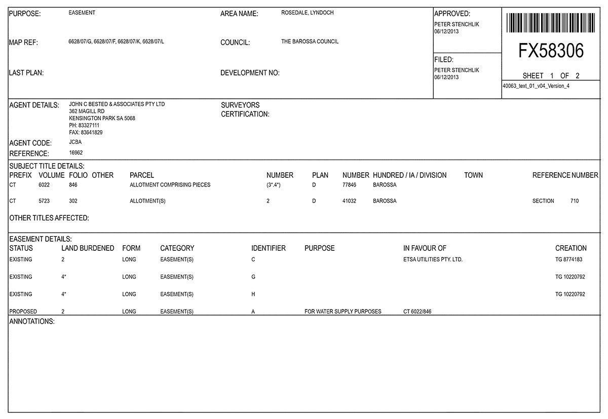
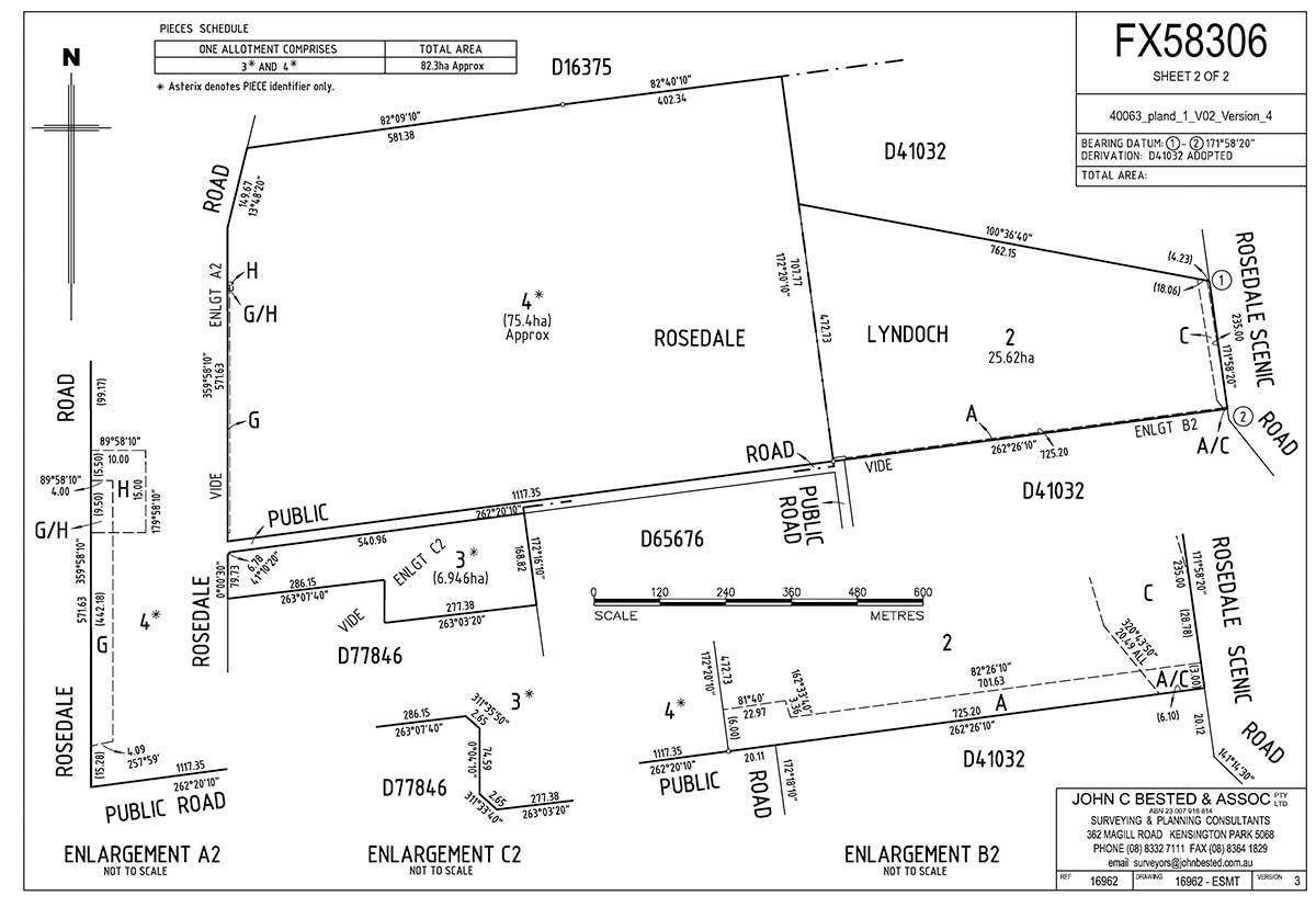
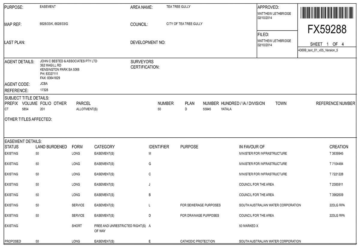
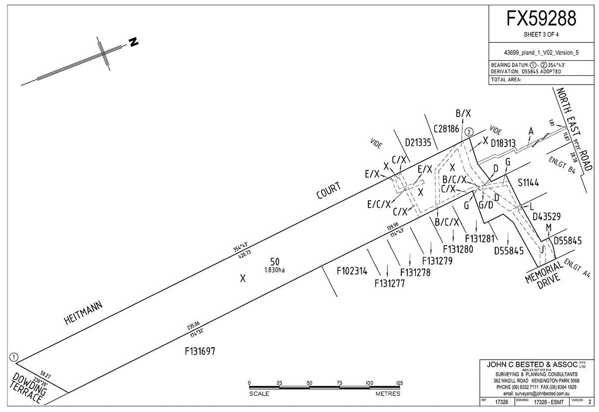
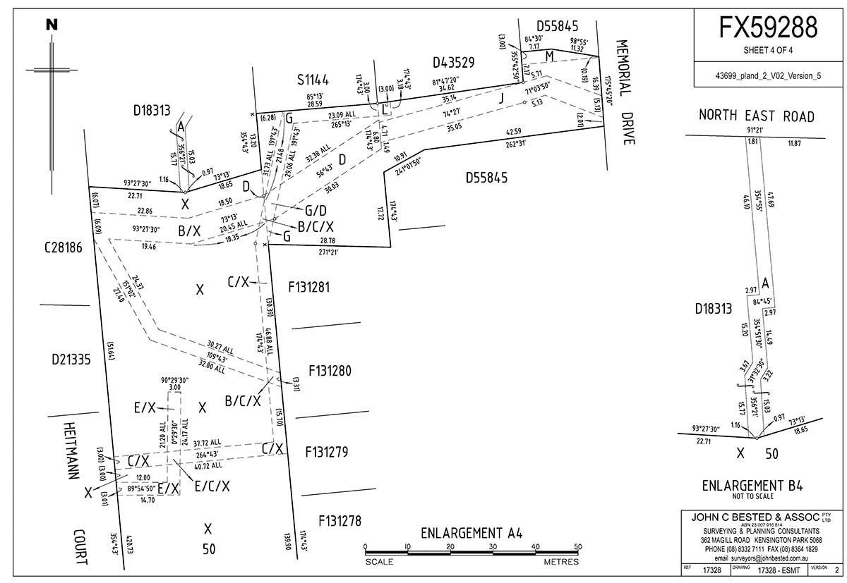
Easement Plans
An easement grants non-possessory rights to use or access part of a property. Common types of easements include:
- Party walls
- Water and electricity supply
- Gas pipelines
- Access roads and walkways
We provide all the necessary survey work and documentation to create, modify, or register easement plans.
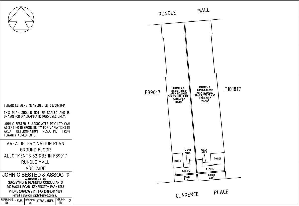
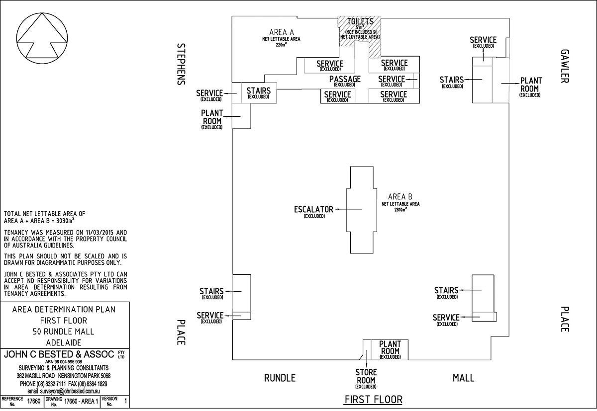
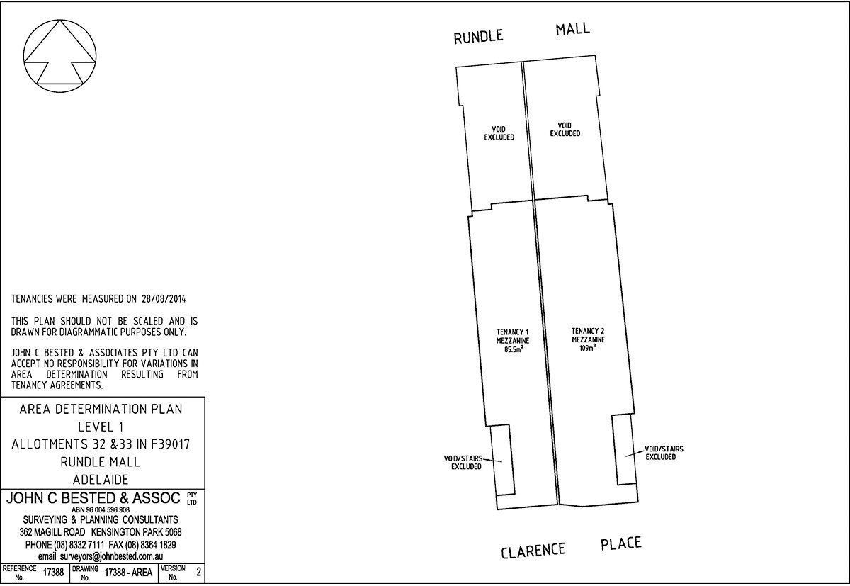
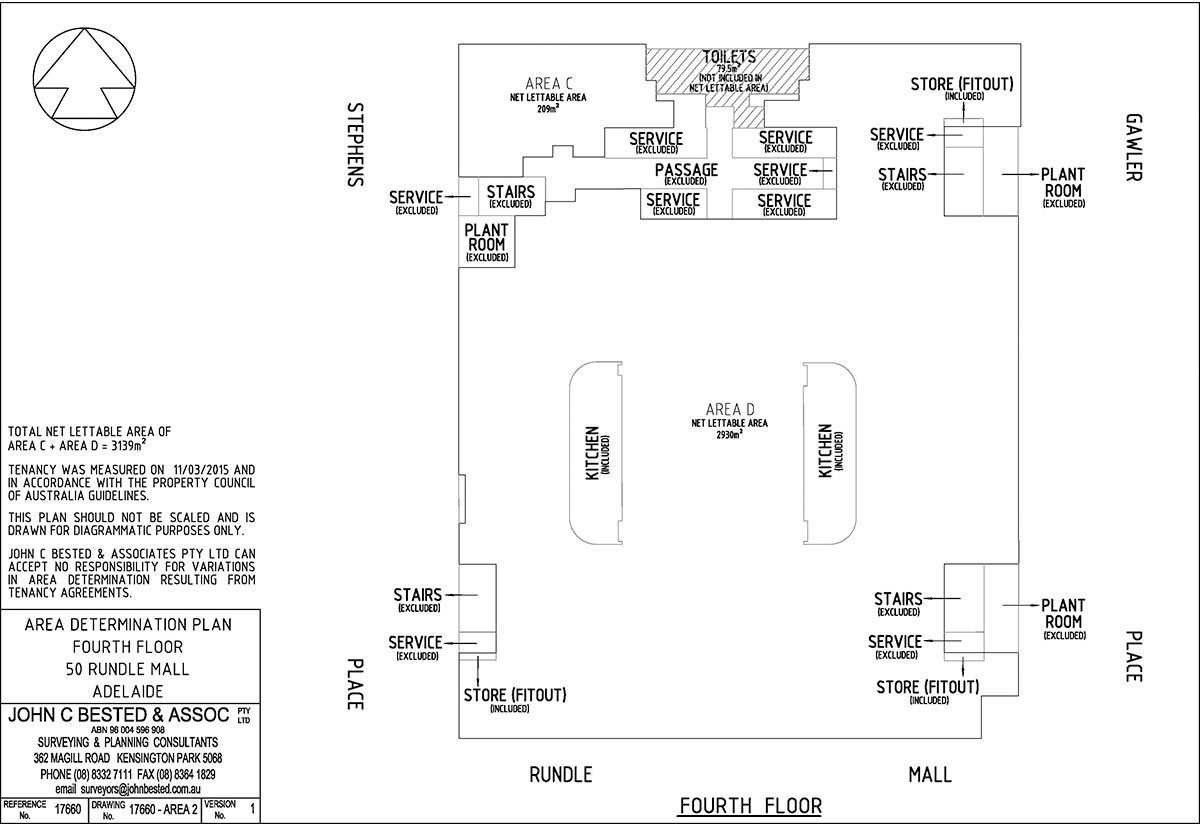
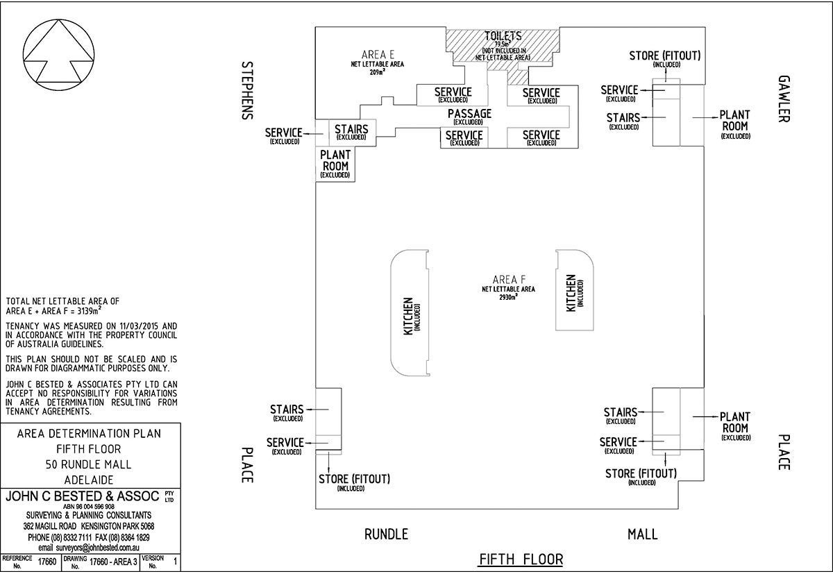
PCA Area Surveys
Our lettable area surveys help determine the usable space for lease negotiations or due diligence during property transactions. We measure areas following Property Council of Australia (PCA) Guidelines, including:
- Net Lettable Area (NLA)
- Gross Lettable Area – Retail (GLAR)
- Gross Lettable Area (GLA)
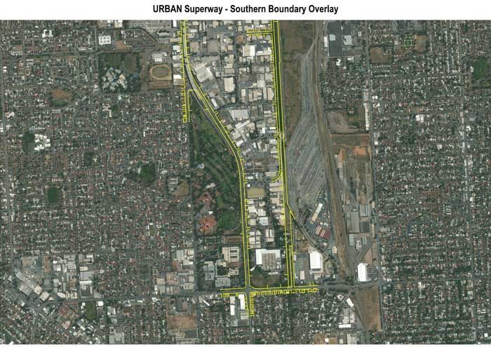
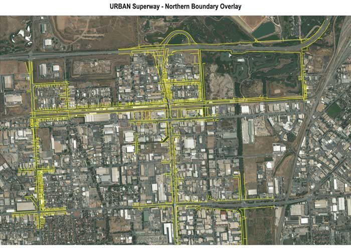
Boundary Overlay for Infrastructure Projects
The creation of accurate cadastral boundary overlays has been a requirement for many large infrastructure projects. They facilitate the need to develop the infrastructure improvements within the desired cadastral corridor and highlight areas for potential land acquisitions.
John Bested Surveyors have been involved with the calculation of boundary overlays for the URBAN Superway project as well as the Adelaide to Noarlunga rail corridor.
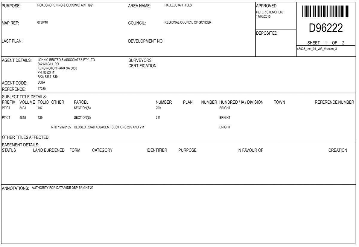
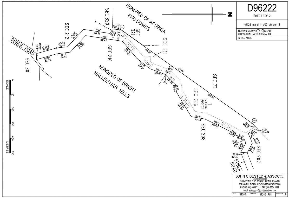
Road Opening & Closing Surveys
We handle the entire process in accordance with the Roads (Opening and Closing) Act 1991, including preparation of preliminary plans, liaison with all the relevant authorities, public consultation process and lodgment of final plans
Due Diligence Surveys
A due diligence survey will provide any prospective buyer with information on a property before they purchase it and are most likely to be carried out as part of large commercial property transactions.
The survey will identify:
- The location of any buildings
- The position and type of fencing
- Identify any easements over the land
- Identify any encroachments
- Highlight any potential discrepancies with the Certificate of Title dimensions
Pharmacy Measurements
If you are establishing a new pharmacy or relocating an existing pharmacy, John Bested Surveyors can prepare the necessary distance measurement plan to include with your application in accordance with the pharmacy location rules as laid out by the Australian Community Pharmacy Authority.
Partner With John C Bested & Associates
With over 50 years of experience and a commitment to excellence and precision, John C Bested & Associates is your trusted partner for land divisions and property surveys in South Australia and Adelaide. From boundary identification to lease plans and subdivisions, we ensure every project is handled carefully and professionally.
Contact us today to learn more about our services or to schedule a consultation for your next project.
Need precise property surveys? Call John C Bested & Associates on 08 8332 7111 for expert assistance in South Australia.